Bicycling Around the Bay in a Day
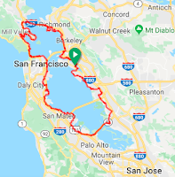
Routes around the San Francisco Bay Area
See Disclaimer belowScroll down to see these routes (anchor links not created yet):
Classics:
1: Around the Bay Century, Clockwise
1a: Around the Bay Century, Clockwise, GRAVEL options1b: Along the Bay Metric+, Clockwise
2: Around the Bay Century, Counter-Clockwise
North Bay:
3: Around the Bay to the North (Clockwise) (not yet created)4: Around the Bay to the North (Counter-Clockwise)
New options, now that Richmond-San Rafael Bridge is open to cyclists:
5: Three Bridges, Clockwise (not yet created)6: Three Bridges, Counter-Clockwise7: Around the Bay including Richmond-San Rafael Bridge, Clockwise (not yet created)8: Around the Bay including Richmond-San Rafael Bridge, Counter-Clockwise
New Double Century options, now that the Richmond-San Rafael Bridge is open to cyclists:
9: Double Century, Clockwise10: Double Century, Counter-Clockwise (approximate)
New Shorter-Ride options, now that the Richmond-San Rafael Bridge is open to cyclists:
11: San Francisco to Oakland (Clockwise)12: Oakland to San Francisco (Counter-Clockwise) (not yet created)
- Around the Bay Century, Clockwise
(Oakland - San Jose - San Francisco)
(Oakland - San Jose - San Francisco)


- Statistics: 100 miles, 1,200' climbing
- Route: https://ridewithgps.com/routes/7118855
- Description:
- Oakland (Fruitvale BART) to San Jose to San Francisco (Embarcadero BART/ferry)
- Uses paved streets and bike paths; optimizes (but does not maximize) use of paved portions of the San Francisco Bay Trail.
- Some sections are in urban / industrial areas (including SFO).
- Bike path near Foster City can have heavy non-bicycle traffic.
- Best to do on a non-work day (due to traffic).
- 1a: Around the Bay Century, Clockwise with GRAVEL options
(Oakland - San Jose - San Francisco)
(Oakland - San Jose - San Francisco)


- Statistics: 107 miles, 1,100' climbing
- Route: https://ridewithgps.com/routes/29966382
- Description:
- Oakland (Fruitvale BART) to San Jose to San Francisco (Embarcadero BART/ferry)
- Modified version of the Clockwise direction to include gravel options.
- Uses paved streets and bike paths; optimizes (but does not maximize) use of paved and gravel portions of the San Francisco Bay Trail.
- Some sections are in urban / industrial areas (including SFO).
- Bike path near Foster City can have heavy non-bicycle traffic.
- Best to do on a non-work day (due to traffic).
- 1b: Along the Bay the Dumbarton Way, Clockwise, Metric+ Distance


- Statistics: 70 miles, 900' climbing
- Route: https://ridewithgps.com/routes/28819714
- Description:
- Downtown Alameda - Dumbarton Bridge - Embarcadero BART/ferry
- Clockwise Around the bay route from Alameda/Oakland, but skipping San Jose in favor of Dumbarton. Ends in San Francisco at Embarcadero (choice of ferry or BART).
- Uses paved streets and bike paths; optimizes (but does not maximize) use of paved portions of the San Francisco Bay Trail.
- Some sections are in urban / industrial areas (including SFO).
- Bike path near Foster City can have heavy non-bicycle traffic.
- Best to do on a non-work day (due to traffic).
- Around the Bay Century, Counter-Clockwise, Near 4 Stadiums
(San Francisco - San Jose - Oakland)
(San Francisco - San Jose - Oakland)


- Statistics: 104 miles, 1,200' climbing
- Route: https://ridewithgps.com/routes/14327740
- Description:
- San Francisco (Embarcadero BART/ferry) to San Jose to downtown Alameda
- More or less a reversal of the Clockwise direction (including near Oracle Park and Chase Center), except that it detours to use a path to go by Levi Stadium, and continues the stadium theme by going near the Oakland Coliseum.
- Uses paved streets and bike paths; optimizes (but does not maximize) use of paved portions of the San Francisco Bay Trail.
- Some sections are in urban / industrial areas (including SFO).
- Bike path near Foster City can have heavy non-bicycle traffic.
- Best to do on a non-work day (due to traffic).
- Around the Bay to the North (route not yet created)
(Clockwise)
(Clockwise)


- Statistics: TBD miles, TBD' climbing
- Route: TBD
- Description:
- San Francisco - Sonoma - Napa - Orinda BART
- Uses paved streets and bike paths.
- Some sections are in urban / industrial areas.
- Avoids Highway 37 and avoids as much of Highway 29 as seemed possible. Has difficult crossing of Highway 12.
- Best to do on a non-work day (due to traffic).
- Around the Bay to the North
(Counter-Clockwise)
(Counter-Clockwise)


- Statistics: 160 miles, 6,000' climbing
- Route: https://ridewithgps.com/routes/2054468
- Description:
- Orinda BART - Napa - Sonoma - San Francisco
- Uses paved streets and bike paths.
- Some sections are in urban / industrial areas.
- Avoids Highway 37 and avoids as much of Highway 29 as seemed possible. Has difficult crossing of Highway 12.
- Best to do on a non-work day (due to traffic).
- Along the Bay the Three Bridge Way:
Dumbarton, Golden Gate, and Richmond-San Rafael (route not yet created)
(Clockwise)
Dumbarton, Golden Gate, and Richmond-San Rafael (route not yet created)
(Clockwise)


- Statistics: TBD miles, TBD' climbing
- Route: TBD
- Description:
- Downtown Alameda - Dumbarton Bridge - Golden Gate Bridge - Richmond-San Rafael Bridge - Point Richmond
- Uses paved streets and bike paths.
- Some sections are in urban / industrial areas.
- Created before Richmond-San Rafael Bridge opened to cyclists in November 2019. Specifics for approaches etc. unknown. DRAFT not yet reviewed at all.
- Best to do on a non-work day (due to traffic).
- Along the Bay the Three Bridge Way:
Richmond-San Rafael, Golden Gate, and Dumbarton
(Counter-Clockwise)
Richmond-San Rafael, Golden Gate, and Dumbarton
(Counter-Clockwise)

- Statistics: 150 miles, 4,200' climbing
- Route: https://ridewithgps.com/routes/30029763
- Description:
- Downtown Alameda - Point Richmond - Richmond-San Rafael Bridge - Golden Gate Bridge - Dumbarton Bridge
- Uses paved streets and bike paths.
- Some sections are in urban / industrial areas.
- Created before Richmond-San Rafael Bridge opened to cyclists in November 2019. Specifics for approaches etc. unknown. DRAFT not yet reviewed at all.
- Best to do on a non-work day (due to traffic).
- Around the Bay the untried but now possible way, including the Richmond-San Rafael Bridge (route not yet created)
(Clockwise)
(Clockwise)


- Statistics: TBD miles, TBD' climbing
- Route: TBD
- Description:
- TBD
- TBD
- Uses paved streets and bike paths; optimizes (but does not maximize) use of paved portions of the San Francisco Bay Trail.
- Some sections are in urban / industrial areas (including SFO).
- Bike path near Foster City can have heavy non-bicycle traffic.
- Best to do on a non-work day (due to traffic).
- Around the Bay the untried but now possible way, including the Richmond-San Rafael Bridge
(Counter-Clockwise)
(Counter-Clockwise)


- Statistics: 175 miles, 4,500' climbing
- Route: https://ridewithgps.com/routes/33081771
- Description:
- Downtown Alameda - Richmond-San Rafael Bridge - Golden Gate Bridge - San Jose - Oakland
- TBD more info
- Uses paved streets and bike paths; optimizes (but does not maximize) use of paved portions of the San Francisco Bay Trail.
- Some sections are in urban / industrial areas (including SFO).
- Bike path near Foster City can have heavy non-bicycle traffic.
- Best to do on a non-work day (due to traffic).
- Around the Bay as a Double Century
(Clockwise)
(Clockwise)


- Statistics: 200 miles, 11,000' climbing
- Route: https://ridewithgps.com/routes/33070014
- Description:
- Downtown Alameda - Lake Chabot - Dublin Grade to Calaveras - San Jose - north to the loop near Stanford and then Cañada Rd - through SFO and 3rd St SF to Golden Gate Bridge - Paradise Loop - Richmond-San Rafael Bridge - Pt Richmond - Bay Trail - Lake Merritt. Most of the climbing is in the first 100 miles (which means the first 100 miles are a hilly century).
- Uses paved streets and bike paths.
- Some sections are in urban / industrial areas (including SFO).
- Bike path near Foster City can have heavy non-bicycle traffic.
- Best to do on a non-work day (due to traffic).
- Around the Bay as a Double Century
(Counter-Clockwise)
(Counter-Clockwise)


- Statistics: 200 miles, 11,000' climbing
- Route: https://ridewithgps.com/routes/30521032
- Description:
- Downtown Alameda - Point Richmond - Richmond-San Rafael Bridge - Golden Gate Bridge - San Jose - Downtown Alameda
- Uses paved streets and bike paths.
- Some sections are in urban / industrial areas.
- This particular version maps to a double century with hills along the peninsula and on Calaveras through Lake Chabot Rd, instead of staying along the water (which would be about 175 miles).
- Might be better to front-load the climbing, by instead routing this clockwise. See below.
- Created before Richmond-San Rafael Bridge opened to cyclists in November 2019. Specifics for approaches etc. unknown. DRAFT not yet reviewed at all.
- Best to do on a non-work day (due to traffic).
- Along the Bay:
San Francisco to Oakland
(Clockwise)
San Francisco to Oakland
(Clockwise)


- Statistics: 65 miles, 2,500' climbing
- Route: https://ridewithgps.com/routes/37993574
- Description:
- Embarcadero, Golden Gate Bridge, Conzelman Rd instead of Alexander Ave to Sausalito, bike path to Strawberry, Tiburon bike path, Paradise Loop, Richmond-San Rafael bridge via bike path / tunnel not Sir Francis Drake, Bay Trail and Port of Oakland / Jack London Square / Embarcadero back to Alameda
- Uses paved streets and bike paths.
- Some sections are in urban / industrial areas.
- Along the Bay:
Oakland to San Francisco (route not yet created)
(Counter-Clockwise)
Oakland to San Francisco (route not yet created)
(Counter-Clockwise)

- Statistics: TBD miles, TBD' climbing
- Route: TBD
- Description:
- TBD
- Uses paved streets and bike paths.
- Some sections are in urban / industrial areas.
- Created before Richmond-San Rafael Bridge opened to cyclists in November 2019. Specifics for approaches etc. unknown. DRAFT not yet reviewed at all.
- Best to do on a non-work day (due to traffic).
Disclaimer
Can't say it any better than RideChronicles.com (no affiliation):
"We all love being out on the open roads for the joy of being able to ride from Point A to Point B and beyond.
The harsh reality is that cycling comes with the inherent risk that sometimes is beyond our control. We share the road with 2-ton vehicles, pedestrians, cyclists and unknown factors on a daily basis. We need to not only ride in a safe manner but to also learn to ride smart. Wear a helmet, obey traffic laws and be courteous to motorists and cyclists alike. Ride with caution and use common sense.
All the maps, rides, route sheets and other data presented are for informational and reference purposes only and may not be 100% accurate. I assume no liability for the information and documents provided on this blog site. You assume total responsibility and risk associated with the use of all materials presented on this site.
Before embarking on any chosen ride, do a little research and check on the local road and weather conditions. Also check traffic conditions as they constantly vary day to day in the densely populated Bay Area."
Here's an organized ride around the bay: https://www.thebayride.com/ (no affiliation).